Irish Weather – The Three-Day Rule
We got some rain at last. On Friday evening I checked the trusty Met Éireann app and saw this:
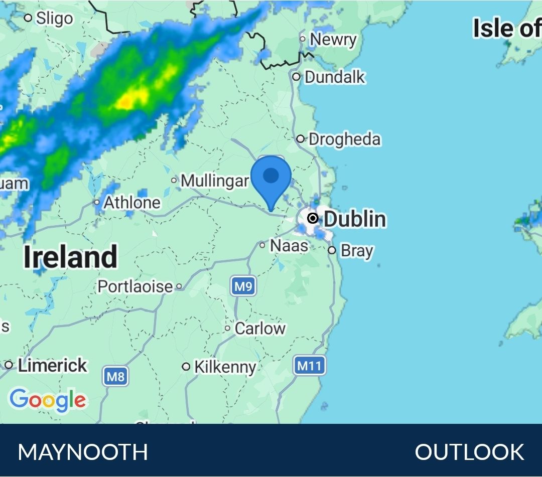
With a west/northwesterly wind I thought there was a good chance we would get a bit of rain, and so it turned out although to be honest there wasn’t that much. I think the greeny-yellowy blobs missed us. There was enough rain to give the garden a little light refreshment but not to make up for the ongoing hosepipe ban. We’ve had several weeks with next to no rain, which is highly unusual.
I look at the weather outlook quite regularly and have learned one thing in my time in Ireland. The forecast is usually fairly accurate up to about three days in the future but you shouldn’t rely on it beyond that. This week provided a good illustration. Last weekend the forecast predicted rain on Saturday (i.e. yesterday). As the week progressed the forecast changed and rain wasn’t forecast until next Wednesday. Then it rained on Friday evening. Saturday, by the way, was extremely humid: well over 90%.
Here’s the outlook from today:
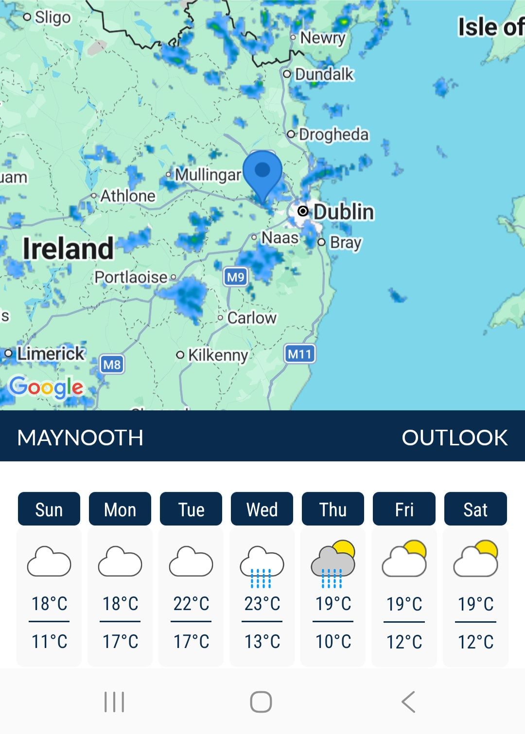
You can see that rain is forecast for Wednesday and Thursday, but the rainfall radar map shows why it is so difficult to predict whether rain will fall at a specific location. The rain clouds are rather small and moving rather quickly; the winds are around 25km/h (westerly). At the time of taking that screen grab there had been some light rain, but will the other blobs hit us? The Met Éireann model says “no” but others may well say “yes”. It’s a tough problem to predict this level of detail.
One thing that I think could be improved is a more reasonable representation of the uncertainty. The outlook for today confidently asserts that the Chance of Preciptation for the rest of today is “0%”. To me that means that it is absolutely impossible that it will rain, and that seems unreasonable to me. Surely there is some chance of rain later today? It doesn’t do much for the credibility of a forecast to claim such certainty. A week or two ago there were no clouds anywhere and “0%” was reasonable, but not today. If it were up to me I’d probably put “<1%” or “<5%” to hedge my bets.
And then there is the question of what amount of rain we’re talking about. I was on campus on Thursday and a few spots of rain fell then. I only noticed because I was outside, coming back from lunch. That was too little to count as real rainfall, but I wonder what the threshold is?


July 26, 2026 at 6:21 pm
It is possible to be more specific than “OK up to 3 days”. Forecasters have a pretty good ideawhat the weather sequence will be for a day or two longer than that, but not the rate at which the sequence will arrive.
Also, a 10% probability of rain might mean “somewhere is definitely going to cop a torrential thunderstorm and there is a 10% chance it is you” and “the extended grey cloud over your region has a 10% chance of shedding rain”. We need some standard deviations as well as means.
July 26, 2026 at 6:34 pm
I suspect the threshold used for rain involves some minimum amount in a specific rain gauge. I’m not sure drizzle even triggers it at all. It is obviously the case that a 10% chance of light drizzle is very different from a 10% chance of a downpour.